Pointor 4 Screenshot
Coordinate Import, Decision Point, Dxf, Excel, Gis, Gps, Import, Import Data, Import Export Directory, Import Export Software, Import Quickbooks, Import Quicken, International Import Export, Land Survey, Oracle Export Import, Oracle Import Export, Point Import, Point List, Quicken Import, Utility
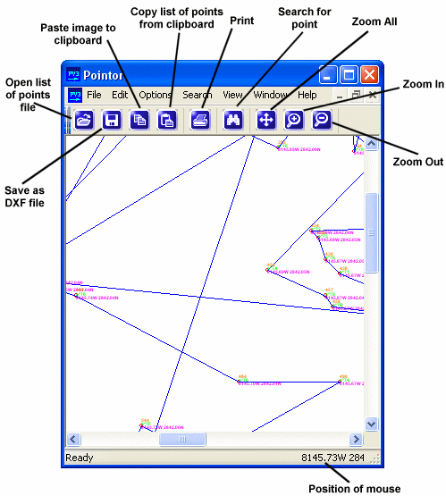
Pointor imports lists of points (2D or 3D) shows them graphically and saves them as a DXF file. The DXF file can then be read by other applications, for example AutoCAD or MicroStation. Search and measuring functions are also included.
|